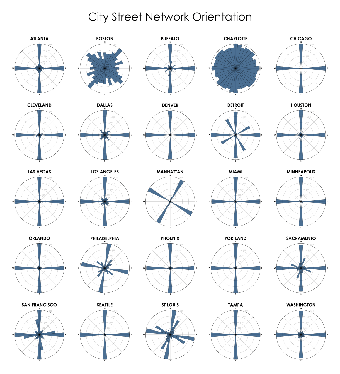
Showing Atlanta the same as Denver means the level of abstraction is so high as to make this meaningless.
East coast cities are more chaotic than this implies, because of time and growth patterns.
Denver was first aligned along the river, then a NS grid later, which this graphic doesn’t show at all. So while it’s primarily a grid, it’s 2 grids, one that’s rotated about 45°.
I’ve driven in a number of these cities, and this graphic really doesn’t reflect the on-the-ground experience.